
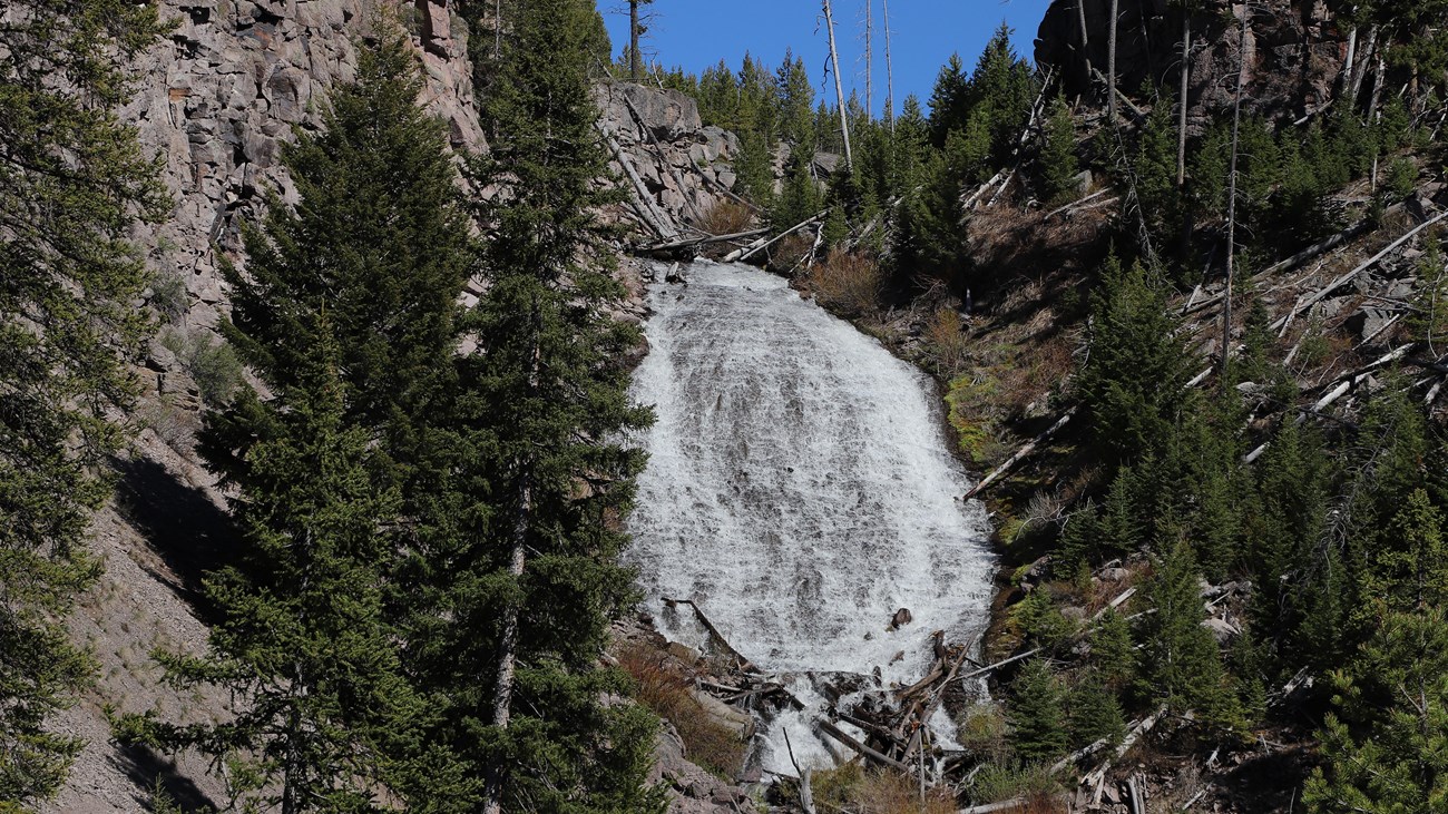
Wraith Falls Trail in Yellowstone is an easy 1-mile out-and-back through sagebrush, marsh, and forest to the base of 79-foot Wraith Falls on Lupine Creek. Most visitors need 30–60 minutes, though the final 245 feet are steep, rocky, and stepped.
This guide covers parking near Lava Creek, the uneven finish, family considerations, an interactive map, and a downloadable GPX track. Browse additional shorter routes in our Hiking with Kids collection.
Trail Details
| Official hike | 1-mile out-and-back |
| GPX coverage | 0.33 mile one way on generalized NPS centerline |
| Difficulty | Easy |
| Time | 30–60 minutes |
| Waterfall | 79 feet |
| Trailhead | Grand Loop Road east of Lava Creek Picnic Area |
Distance note: the official map centerline is shorter than the NPS one-mile outing. Use the GPX for orientation and follow the maintained trail and signs to the waterfall.
Wraith Falls Trail map and GPX
The map follows the NPS centerline from the road pullout toward Wraith Falls. GPX Viewer supplies the article’s single route-download button.
wraith-falls-trail GPX
| Name: | No data |
| Distance: | No data |
| Minimum elevation: | No data |
| Maximum elevation: | No data |
| Elevation gain: | No data |
| Elevation loss: | No data |
| Duration: | No data |
What the hike is like
The route begins across open sagebrush and marshy ground before entering mixed conifer forest. The waterfall spreads down a sloping rock face rather than dropping in one vertical plunge. Water volume and trail moisture vary through the year.
Do not let the easy rating hide the finish: the last 245 feet are steep and rocky with steps. The NPS does not classify the trail as accessible because of this topography.
Directions and parking
The trail begins at a pullout about one-half mile east of Lava Creek Picnic Area on the Grand Loop Road, south of Mammoth Hot Springs. Pull fully into a legal space and watch carefully for traffic when entering or leaving the road.
Is Wraith Falls Trail good for kids?
The short distance can work well for children who can manage rocks and steps. Adults should keep children close beside the road, on the final steep section, and anywhere wildlife is present. A child carrier may be more practical than a stroller. Pets are not allowed.
Put the GPX on your watch
- Download the GPX from the map.
- Garmin: import it as a Course in Garmin Connect and sync it.
- COROS: add it to the COROS route library and sync it.
- Apple Watch: use WorkOutDoors, Footpath, Gaia GPS, or another GPX-capable app.
- For another device, look for GPX import under Routes, Courses, or Navigation.
- Keep following the maintained trail when the generalized centerline ends.
Wildlife, footing, and current conditions
Carry bear spray where it is immediately accessible, give every animal the required distance, and never use the short trail as a reason to skip wildlife precautions. Rock steps can be slick with rain, ice, or spray. Check current Yellowstone conditions before driving to the trailhead.
Wraith Falls Trail FAQ
How long is Wraith Falls Trail?
The official hike is 1 mile round trip and usually takes 30–60 minutes.
Is Wraith Falls Trail accessible?
No. The National Park Service notes that the final 245 feet are steep and rocky with steps.
Is the trail open year-round?
The NPS lists year-round use, but road access, snow, ice, and temporary closures still determine whether a hike is practical on a particular day.
Related Yellowstone hikes
- Bunsen Peak Trail — a much steeper summit hike south of Mammoth
- Beaver Ponds Trail — a longer loop from the Mammoth area
This generalized GPX is for planning and does not replace trail signs or current NPS instructions. Facts checked against the National Park Service Wraith Falls Trail guide. GPX source: official NPS map centerlines.