
Lost Lake Trail in Yellowstone is a moderate 2.8-mile loop from Roosevelt Lodge through forest and wildlife habitat to Lost Lake and the Petrified Tree area. The route climbs about 300 feet onto a bench and normally takes 1–2 hours.
This guide covers both trailhead choices, bears and bison, horse etiquette, the loop’s mapped gaps, an interactive map, and a downloadable GPX track. Browse more options in our Yellowstone Trails collection.
Trail Details
| Official hike | 2.8-mile loop |
| GPX coverage | 2.87 mapped miles in two track segments |
| Elevation gain | About 300 feet |
| Difficulty | Moderate |
| Time | 1–2 hours |
| Trailheads | Roosevelt Lodge or Petrified Tree parking area |
Map note: separate GPX segments preserve short gaps in the NPS centerline near developed areas. Follow current trail signs through the Roosevelt and Petrified Tree connections.
Lost Lake Trail map and GPX
The map shows the official loop alignment between Roosevelt Lodge, Lost Lake, and the Petrified Tree area. GPX Viewer provides the page’s single download button.
lost-lake-trail GPX
| Name: | No data |
| Distance: | No data |
| Minimum elevation: | No data |
| Maximum elevation: | No data |
| Elevation gain: | No data |
| Elevation loss: | No data |
| Duration: | No data |
What the loop is like
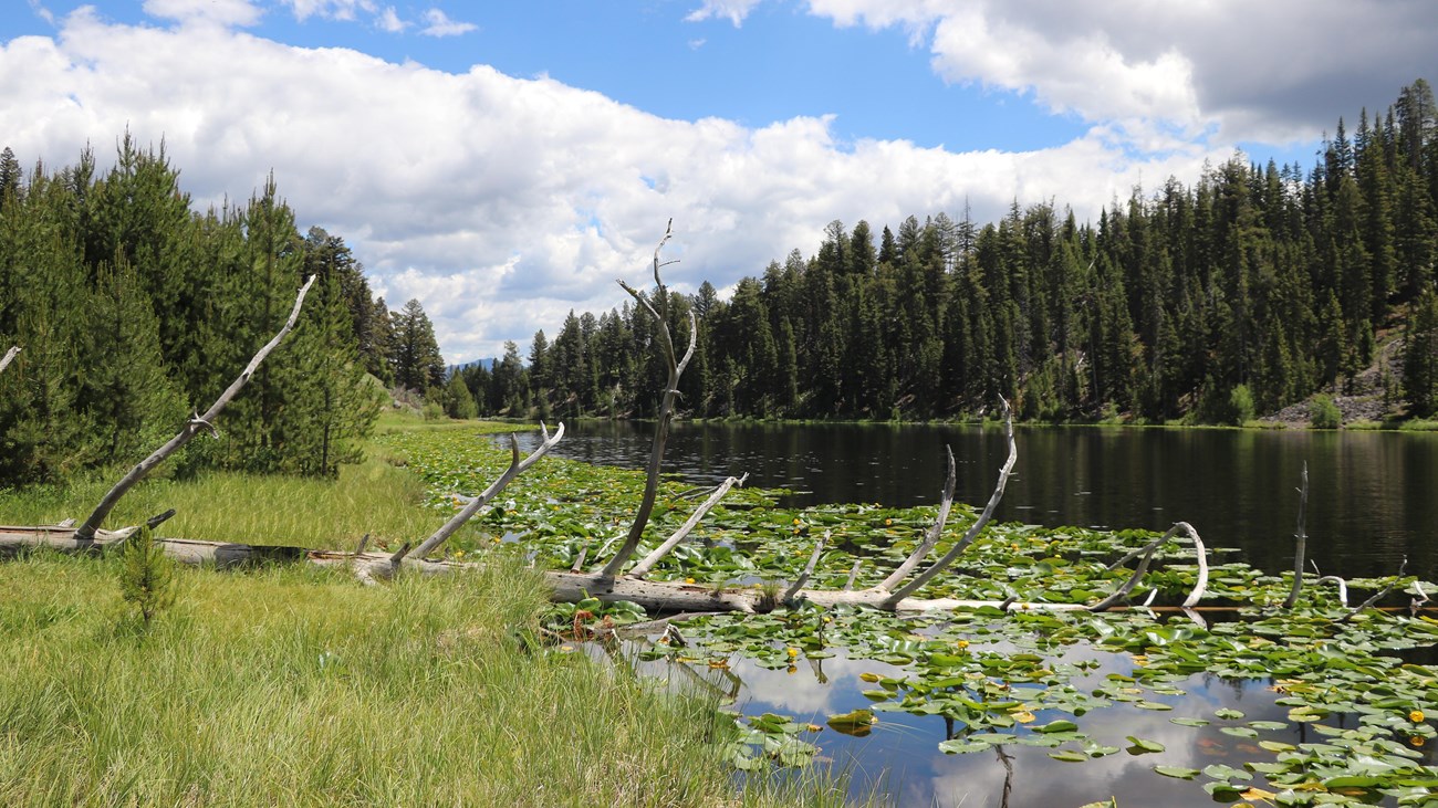
Starting behind Roosevelt Lodge, the trail climbs roughly 300 feet to a forested bench, joins a horse route, and continues west to lily-covered Lost Lake. The loop then contours toward the Petrified Tree parking area before returning behind Tower Ranger Station and across the creek.
The landscape mixes forest, small meadows, lake edge, and developed-area connections. Bears and bison are common enough that the NPS specifically calls for caution; a quiet lake does not mean the surrounding trail is empty.
Trailheads and parking choices
Begin behind Roosevelt Lodge or at the end of the Petrified Tree parking lot west of Tower Junction. Roosevelt services and lodging operate seasonally even though the NPS lists the trail for year-round use. Confirm road and facility access before choosing a start.
Horse, bear, and bison etiquette
The trail is frequented by horses. When stock approaches, move to the downhill side and remain still until the animals pass. Carry bear spray, keep it reachable, and give bears and bison the distances required by the park. Never place yourself between wildlife and its escape route.
Put the GPX on your watch
- Download the GPX from the map.
- Garmin: import it as a Course in Garmin Connect and sync it.
- COROS: add it to the COROS route library and sync it.
- Apple Watch: use WorkOutDoors, Footpath, Gaia GPS, or another GPX-capable app.
- For another device, look for GPX import under Routes, Courses, or Navigation.
- Review the two mapped segments and use signs through every developed-area gap.
Season and current conditions
Check current Yellowstone conditions and the backcountry situation report. Snow, mud, wildlife activity, horse use, fire, or temporary closures can change the outing.
Lost Lake Trail FAQ
How long is Lost Lake Trail?
The official loop is 2.8 miles and usually takes 1–2 hours.
Where should I start the loop?
Roosevelt Lodge is the usual descriptive starting point, but the NPS also allows starting from the Petrified Tree parking area. Choose based on current access and legal parking.
Why does the GPX have separate segments?
The official source centerline contains short gaps near developed areas. The package preserves those gaps instead of drawing invented connecting lines.
Related Yellowstone hikes
- Slough Creek Trail — a longer wildlife-country hike east of Tower Junction
- Trout Lake Trail — a shorter northeast lake loop
This generalized GPX is for planning and does not replace trail signs or current NPS instructions. Facts checked against the National Park Service Lost Lake Trail guide. GPX source: official NPS map centerlines.