
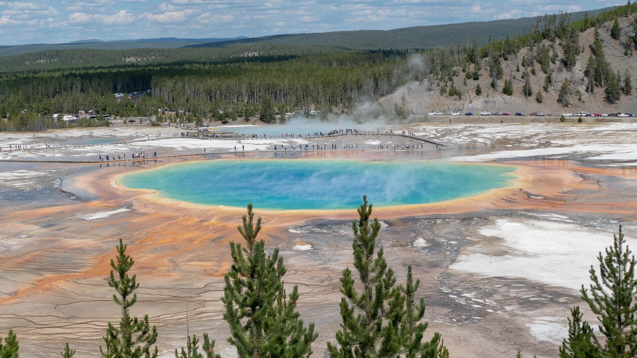
Grand Prismatic Overlook Trail in Yellowstone is an easy 1.2-mile out-and-back from the Fairy Falls parking area to an elevated view over Grand Prismatic Spring and Midway Geyser Basin. The National Park Service lists 105 feet of climbing and a typical time of 1–2 hours.
This guide covers the signed approach, limited parking, crowd and thermal-area safety, an interactive map, and a downloadable GPX track. Find more highly recommended routes in our Best Hikes collection.
Trail Details
| Official hike | 1.2-mile out-and-back |
| GPX coverage | 0.79 mile one way on NPS mapped centerlines |
| Elevation gain | 105 feet |
| Difficulty | Easy |
| Time | 1–2 hours |
| Trailhead | Fairy Falls parking area |
Distance note: the official NPS page rounds the outing to 1.2 miles. The generalized GPX follows the full mapped centerline and overlook spur, so its one-way length is longer. Follow current signs rather than relying on mileage alone.
Grand Prismatic Overlook Trail map and GPX
The map begins at the Fairy Falls parking area, follows the shared freight-road approach, and climbs the signed pedestrian spur toward the overlook. GPX Viewer provides the page’s single download button.
grand-prismatic-overlook-trail GPX
| Name: | No data |
| Distance: | No data |
| Minimum elevation: | No data |
| Maximum elevation: | No data |
| Elevation gain: | No data |
| Elevation loss: | No data |
| Duration: | No data |
What the overlook hike is like
The first portion uses the broad Fairy Falls approach through young lodgepole pine forest. At the signed junction, the overlook path climbs to a platform above the spring. The grade is modest, but the spur is narrower and can feel busy when groups arrive together.
The elevated angle reveals the spring’s blue center and colorful microbial mats more clearly than the Midway Geyser Basin boardwalk. Steam can obscure the view during cold weather, so visibility is never guaranteed.
Directions and very limited parking
Use the Fairy Falls parking area about 1 mile south of Midway Geyser Basin. The National Park Service describes parking as very limited. Arrive early, use only legal spaces, and never stop in the travel lane while waiting. If the lot is full, return later rather than inventing a roadside space.
Thermal-area and family safety
This can be a practical family hike for children comfortable walking more than a mile, but adults must control the group near thermal ground and on the crowded platform. Stay on the designated trail, do not cross closures for a photograph, and keep hands and feet away from hot runoff. Pets are not permitted on the trail.
Put the GPX on your watch
- Download the GPX from the map.
- Garmin: import it as a Course in Garmin Connect and sync it.
- COROS: add it to the COROS route library and sync it.
- Apple Watch: use WorkOutDoors, Footpath, Gaia GPS, or another GPX-capable app.
- For another device, look for GPX import under Routes, Courses, or Navigation.
- Confirm that the one-way track and your offline park map are available before leaving service.
Season and current conditions
The NPS lists winter, summer, and fall use, but road access, snow, closures, and parking conditions change. Check current Yellowstone conditions and the backcountry situation report before starting.
Grand Prismatic Overlook Trail FAQ
How long is Grand Prismatic Overlook Trail?
The National Park Service lists a 1.2-mile out-and-back with 105 feet of climbing. Allow 1–2 hours, especially when parking or the overlook is busy.
Is the overlook the same as the Midway boardwalk?
No. The overlook begins at the Fairy Falls parking area south of Midway. The boardwalk approaches Grand Prismatic Spring from a different parking area at ground level.
Can I combine the overlook with Fairy Falls?
Yes. The routes share their initial approach. Use the Fairy Falls Trail guide to understand the longer mileage, junctions, map, and GPX track.
Related Yellowstone hikes
- Fairy Falls Trail — continue through the forest to a 200-foot waterfall
- Mystic Falls Trail — another geyser-basin-area waterfall hike
This generalized GPX is for planning and does not replace trail signs or current NPS instructions. Facts checked against the National Park Service Grand Prismatic Overlook Trail guide. GPX source: official NPS map centerlines.