
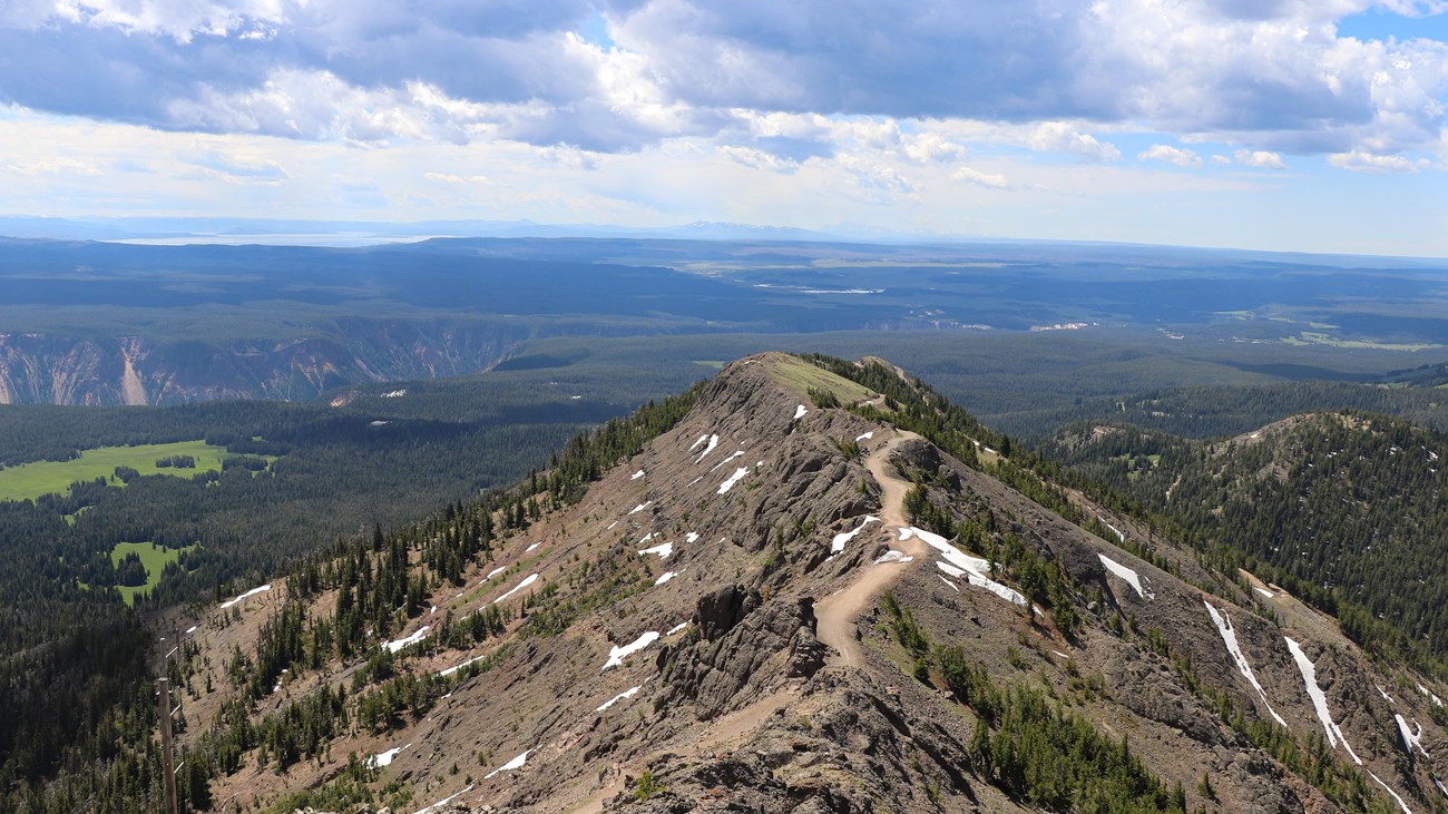
Mount Washburn Trail from Dunraven Pass is a strenuous 6-mile out-and-back to one of Yellowstone’s best-known high summits. The broad trail climbs through wildflower meadows and open slopes to a lookout area with far-reaching park views.
This guide covers parking, altitude and lightning risks, an interactive route map, and a downloadable one-way GPX track. Compare it with other standout routes in our Best Hikes collection.
Trail Details
| Full hike | 6-mile out-and-back |
| GPX coverage | 3.50 miles one way |
| Difficulty | Strenuous |
| Time | 3–6 hours |
| Summit elevation | 10,219 feet |
| Trailhead | Dunraven Pass |
Distance note: the GPX is one way and measures longer than the NPS’s generalized 3-mile approach. Retrace the route to return and use 6 miles as the official full-hike figure.
Mount Washburn Trail map and GPX
The map follows the Dunraven Pass route to the summit. GPX Viewer supplies this page’s only route-download button.
mount-washburn-trail GPX
| Name: | No data |
| Distance: | No data |
| Minimum elevation: | No data |
| Maximum elevation: | No data |
| Elevation gain: | No data |
| Elevation loss: | No data |
| Duration: | No data |
What the hike is like
The trail climbs steadily from Dunraven Pass through forests, wildflower slopes, and increasingly open alpine terrain. Bighorn sheep are sometimes seen near the upper mountain. At the summit, a shelter at the base of the fire lookout offers limited refuge, but it is not a substitute for safe weather judgment.
The high point exceeds 10,000 feet, so cooler temperatures, strong wind, rapid storms, and altitude can affect hikers even when the parking area feels warm. There is no water along the route.
Directions and parking
Dunraven Pass is about 4.5 miles north of Canyon Junction on Grand Loop Road. The pass parking area is limited and roadside congestion can be significant; park only in designated spaces and consider another hike if the lot is full.
Put the GPX on your watch
- Download the GPX from the map.
- Garmin: import it as a Course in Garmin Connect and sync it.
- COROS: save it to the COROS route library and sync it.
- Apple Watch: import it with WorkOutDoors, Footpath, Gaia GPS, or another GPX-capable app.
- For another device, look for GPX import under Routes, Courses, or Navigation.
- Verify the one-way summit track is available offline, then retrace it to Dunraven Pass.
Lightning, bears, and current conditions
Start early and turn around if storms build; the upper trail is exposed and lightning is a serious hazard. Bears may use the area, especially in fall, so carry bear spray and follow all closures. Check current Yellowstone conditions, the road status, and the backcountry situation report before leaving.
Mount Washburn Trail FAQ
How long does Mount Washburn take from Dunraven Pass?
Plan 3–6 hours for the official 6-mile round trip. Weather, altitude, crowds, and time at the summit can change the total.
Is Mount Washburn Trail difficult?
Yes. The NPS rates the route strenuous because of sustained climbing, high elevation, exposure, and rapidly changing mountain weather.
When should I turn around?
Turn around before lightning, heavy wind, poor visibility, illness, or fatigue makes the exposed upper mountain unsafe. Reaching the summit is optional; returning safely is the priority.
Related Yellowstone hikes
- Avalanche Peak Trail — another strenuous Yellowstone summit route
- Beaver Ponds Trail — a lower-elevation wildlife loop near Mammoth
This generalized GPX is for planning and does not replace trail signs, an official map, or current NPS instructions. Facts checked against the National Park Service Mount Washburn from Dunraven Pass guide. GPX source: NPS Yellowstone trail centerline data.