
Brink of the Lower Falls Trail in Yellowstone is a very steep 0.7-mile out-and-back that descends about 600 feet to the edge of the park’s 308-foot Lower Falls. The hike is short, but the climb back to the North Rim is strenuous.
This guide covers parking, the descent, health and weather considerations, an interactive map, and a downloadable GPX track. Compare more standout routes in our Best Hikes collection.
Trail Details
| Full hike | 0.7-mile out-and-back |
| GPX coverage | 0.36 mile one way |
| Difficulty | Very steep and strenuous |
| Elevation change | About 600 feet each direction |
| Waterfall | 308-foot Lower Falls |
| Trailhead | Brink of Lower Falls parking area, North Rim Drive |
Distance note: the GPX maps the 0.36-mile descent. Retrace it uphill for the official 0.7-mile round trip.
Brink of the Lower Falls map and GPX
The interactive map follows the steep path from the North Rim parking area toward the brink. GPX Viewer supplies this page’s single download button.
brink-of-the-lower-falls-trail GPX
| Name: | No data |
| Distance: | No data |
| Minimum elevation: | No data |
| Maximum elevation: | No data |
| Elevation gain: | No data |
| Elevation loss: | No data |
| Duration: | No data |
What the hike is like
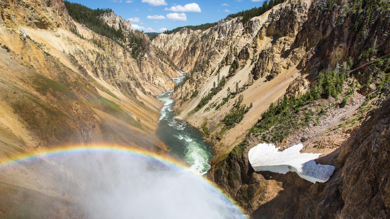
The paved trail loses elevation quickly through a series of switchbacks. At the bottom, the Yellowstone River pours over Lower Falls directly beside the viewing area, sending mist into the Grand Canyon of the Yellowstone. A short spur near the top also offers a view toward Upper Falls.
Every downhill step must be regained. Pace the ascent, carry water, and give uphill hikers room. The NPS does not recommend this trail for visitors with heart, lung, or other health conditions affected by steep exertion.
Directions and parking
Use the Brink of Lower Falls parking area on North Rim Drive in the Canyon Village area. North Rim Drive is one way, parking is busy, and the steep trail is closed in winter. Do not stop or park outside designated spaces.
Put the GPX on your watch
- Download the GPX from the map.
- Garmin: import it as a Course in Garmin Connect and sync it.
- COROS: add it to the COROS route library and sync it.
- Apple Watch: import it with WorkOutDoors, Footpath, Gaia GPS, or another GPX-capable app.
- For another device, look for GPX import under Routes, Courses, or Navigation.
- Confirm that the one-way descent is available offline and retrace it to return.
Weather and current conditions
Mist can make surfaces wet, and ice or snow can close the route. Check current Yellowstone conditions and Canyon-area guidance before visiting.
Brink of the Lower Falls Trail FAQ
How difficult is Brink of the Lower Falls Trail?
It is strenuous despite being only 0.7 mile round trip. The trail descends about 600 feet, and the entire elevation loss becomes a steep return climb.
How tall is Lower Falls?
Lower Falls drops 308 feet into the Grand Canyon of the Yellowstone.
Is the trail open in winter?
No. The NPS identifies the steep brink trail as closed in winter. Always confirm current access before driving the rim.
Related Yellowstone hikes
- Mount Washburn Trail — a longer strenuous hike north of Canyon Village
- Elephant Back Mountain Trail — a forested climb to a Yellowstone Lake overlook
This generalized GPX is for planning and does not replace trail signs or current NPS instructions. Facts checked against the National Park Service Brink of the Lower Falls Trail guide. GPX source: NPS Yellowstone trail centerline data.