
Lone Star Geyser Trail in Yellowstone is an easy 4.8-mile out-and-back along the Firehole River to a backcountry geyser that can erupt roughly every three hours. The broad, mostly paved former service road is shared by hikers and cyclists.
This guide covers timing, parking, bike etiquette, an interactive route map, and a downloadable GPX track. See more options in our Yellowstone Trails collection.
Trail Details
| Full hike | 4.8-mile out-and-back |
| GPX coverage | 2.66 miles one way |
| Difficulty | Easy |
| Time | 2–3 hours, plus any eruption wait |
| Surface | Mostly paved former service road |
| Trailhead | Beyond Kepler Cascades, south of Old Faithful |
Distance note: the GPX is a generalized one-way line. Return on the same route and use the NPS’s 4.8-mile official distance for planning.
Lone Star Geyser Trail map and GPX
The map follows the Firehole River corridor from the trailhead to Lone Star Geyser. GPX Viewer supplies the page’s only download button.
lone-star-geyser-trail GPX
| Name: | No data |
| Distance: | No data |
| Minimum elevation: | No data |
| Maximum elevation: | No data |
| Elevation gain: | No data |
| Elevation loss: | No data |
| Duration: | No data |
What the hike is like
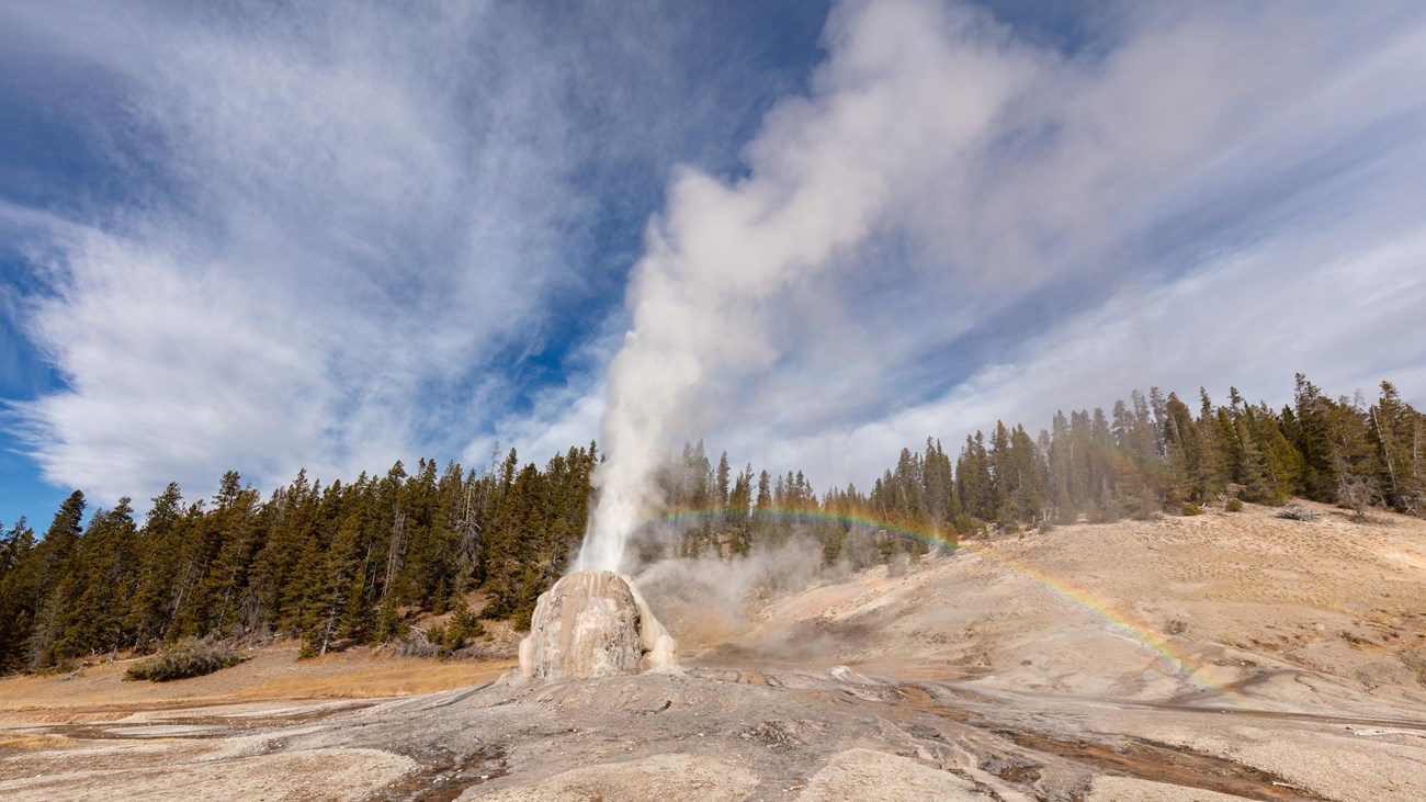
The route follows a gentle old road beside the Firehole River through lodgepole forest. Lone Star’s cone sits in a clearing at the end; major eruptions can reach about 45 feet and may occur roughly every three hours, but nature does not keep a guaranteed schedule.
Look for recent eruption notes in the logbook if one is present and decide how long you are willing to wait. Carry water and layers—the easy grade can disguise the trail’s nearly five-mile round trip.
Directions, parking, and biking
Turn into the Lone Star trailhead about 3.5 miles south of the Old Faithful overpass, just beyond the Kepler Cascades parking area. Cyclists may use the old service road but should yield to walkers and dismount where the paved route ends near the geyser.
Put the GPX on your watch
- Download the GPX from the map.
- Garmin: import it as a Course in Garmin Connect and sync it.
- COROS: add it to the COROS route library and sync it.
- Apple Watch: import it with a GPX-capable app such as WorkOutDoors, Footpath, or Gaia GPS.
- For another device, look for GPX import under Routes, Courses, or Navigation.
- Verify that the one-way line is saved offline, then retrace it to return.
Thermal safety and current conditions
Never touch thermal water or walk on thin ground around the geyser. Stay on the established route and obey closure signs. Check current Yellowstone conditions and the backcountry situation report before going.
Lone Star Geyser Trail FAQ
How often does Lone Star Geyser erupt?
The NPS says eruptions occur roughly every three hours. That interval is approximate, so allow extra time and do not count on a specific show.
Can you bike to Lone Star Geyser?
Yes, bicycles are allowed on the old service road. Yield to hikers and dismount at the end of the paved route near the geyser.
Is Lone Star Geyser Trail paved?
Much of the former service road is paved, but conditions are not equivalent to an urban path and the final geyser area requires thermal-feature caution.
Related Yellowstone hikes
- Fairy Falls Trail — an easy waterfall hike near Grand Prismatic Spring
- Mystic Falls Trail — a waterfall route in the Upper Geyser Basin area
This generalized GPX is for planning and does not replace trail signs, an official map, or current NPS instructions. Facts checked against the National Park Service Lone Star Geyser Trail guide. GPX source: NPS Yellowstone trail centerline data.