
Fairy Falls Trail in Yellowstone is an easy 5.4-mile out-and-back to a slender 200-foot waterfall near Grand Prismatic Spring. The mostly level route crosses the Firehole River and follows old roads and forest trail to the base of the falls.
This guide covers the best trailhead, parking, the optional Spray and Imperial geyser extension, an interactive map, and a downloadable GPX track. For more ideas, start with our Hiking in Yellowstone guide.
Trail Details
| Full hike | 5.4-mile out-and-back from the Fairy Falls parking lot |
| GPX coverage | 2.47 miles one way |
| Difficulty | Easy |
| Time | 3–5 hours |
| Highlight | 200-foot Fairy Falls |
| Trailhead | Fairy Falls parking lot, south of Midway Geyser Basin |
Distance note: the GPX is one way. Retrace it to return; use the NPS’s 5.4-mile figure for the complete outing.
Fairy Falls Trail map and GPX
The interactive map shows the route from the Fairy Falls parking area to the waterfall. GPX Viewer provides this article’s single download button.
fairy-falls-trail GPX
| Name: | No data |
| Distance: | No data |
| Minimum elevation: | No data |
| Maximum elevation: | No data |
| Elevation gain: | No data |
| Elevation loss: | No data |
| Duration: | No data |
What the hike is like
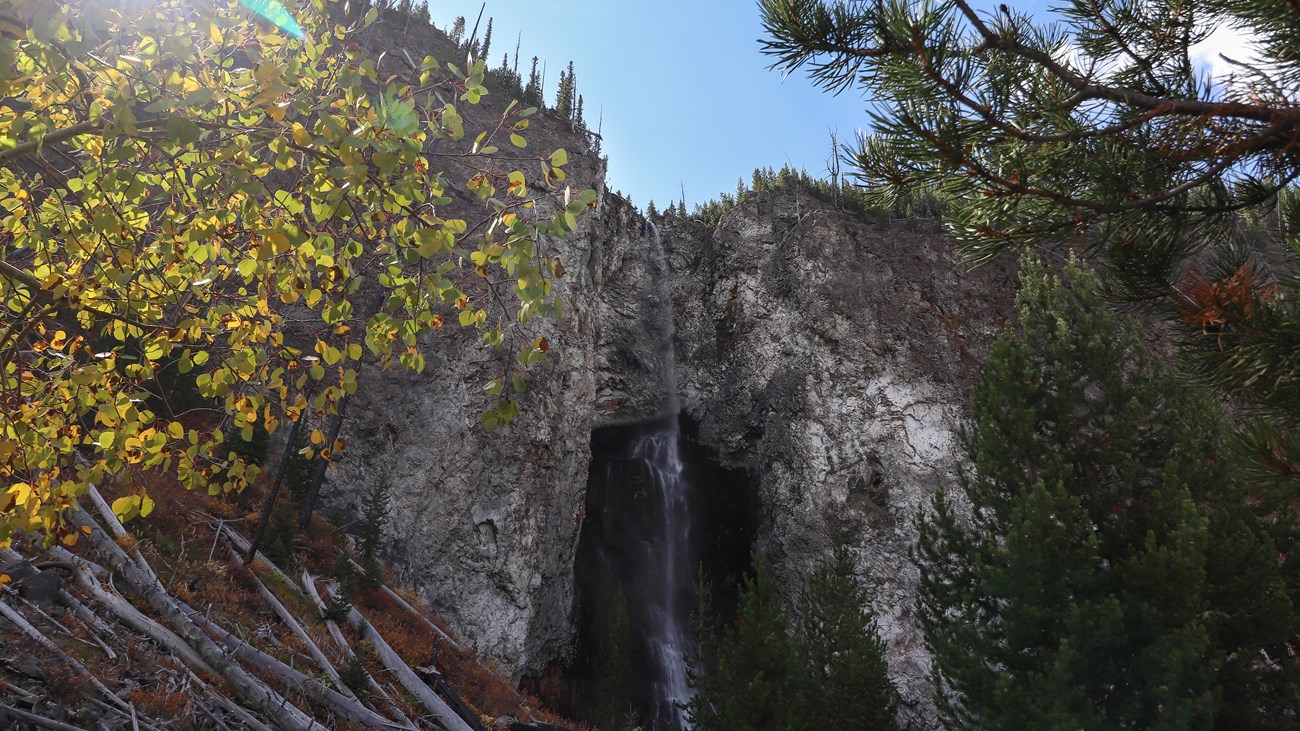
From the parking lot, cross the Firehole River and follow the broad path toward the Grand Prismatic Spring overlook junction. Continue through lodgepole pine forest to Fairy Falls, where the water drops from a high cliff into a shallow pool.
The falls are the turnaround for the standard hike. If time and conditions allow, the NPS describes an optional continuation of about 0.6 mile to Spray Geyser and Imperial Geyser. Stay on marked trails and boardwalks around every thermal feature.
Directions and parking
The Fairy Falls parking lot is about 1 mile south of Midway Geyser Basin on Grand Loop Road. Parking is limited and the corridor is extremely busy, so arrive early and never park outside designated spaces. A second NPS approach begins near Fountain Flat Drive and produces a different total distance.
Put the GPX on your watch
- Download the GPX from the map.
- Garmin: import it as a Course in Garmin Connect and sync it to your compatible watch.
- COROS: add it to the route library in the COROS app and sync it.
- Apple Watch: import it with a GPX-capable app such as WorkOutDoors, Footpath, or Gaia GPS.
- For another device, look for GPX import under Routes, Courses, or Navigation.
- Confirm that the track is available offline and remember that it ends at the falls.
Thermal, wildlife, and current conditions
Carry bear spray, keep a safe distance from wildlife, and stay on established surfaces near thermal areas. Trail access can change after fires, wildlife activity, or geothermal events. Check the official Yellowstone conditions and backcountry situation report before leaving.
Fairy Falls Trail FAQ
How long is Fairy Falls Trail?
The standard outing from the Fairy Falls parking lot is 5.4 miles round trip. The supplied GPX is a 2.47-mile one-way planning line, so retrace it to return.
Is Fairy Falls Trail difficult?
The NPS rates the trail easy. It is fairly level, but the distance, sun exposure, crowds, and changing weather still require water, layers, and preparation.
Can I add the Grand Prismatic overlook?
Yes. The overlook uses a signed spur from the same approach. Add time and mileage, and follow current signs because thermal-area access can change.
Related Yellowstone hikes
- Lone Star Geyser Trail — an easy Firehole-area route to a backcountry geyser
- Mystic Falls Trail — a shorter waterfall hike near Biscuit Basin
This generalized GPX is for planning and does not replace trail signs, an official map, or current NPS instructions. Facts checked against the National Park Service Fairy Falls Trail guide. GPX source: NPS Yellowstone trail centerline data.