
Slough Creek Trail in Yellowstone is a moderate 3.4-mile out-and-back to the first meadow in the park’s northeast corner. The historic wagon road climbs steeply at first, then drops into broad wildlife habitat along a popular fishing stream.
This guide covers the first-meadow day hike, optional second-meadow extension, parking, horse etiquette, an interactive map, and a downloadable GPX track. Browse more options in our Yellowstone Trails collection.
Trail Details
| Standard day hike | 3.4-mile out-and-back to first meadow |
| GPX coverage | 1.68 miles one way to first meadow |
| Optional extension | 8.6 miles round trip to second meadow |
| Difficulty | Moderate |
| Time | 2–5 hours |
| Trailhead | Slough Creek Campground road |
Distance note: the GPX ends at the first meadow. Retrace it for the 3.4-mile standard hike; it does not include the second-meadow extension.
Slough Creek Trail map and GPX
The map follows the wagon road from the trailhead to the first meadow. GPX Viewer supplies the page’s single route-download button.
slough-creek-trail GPX
| Name: | No data |
| Distance: | No data |
| Minimum elevation: | No data |
| Maximum elevation: | No data |
| Elevation gain: | No data |
| Elevation loss: | No data |
| Duration: | No data |
What the hike is like
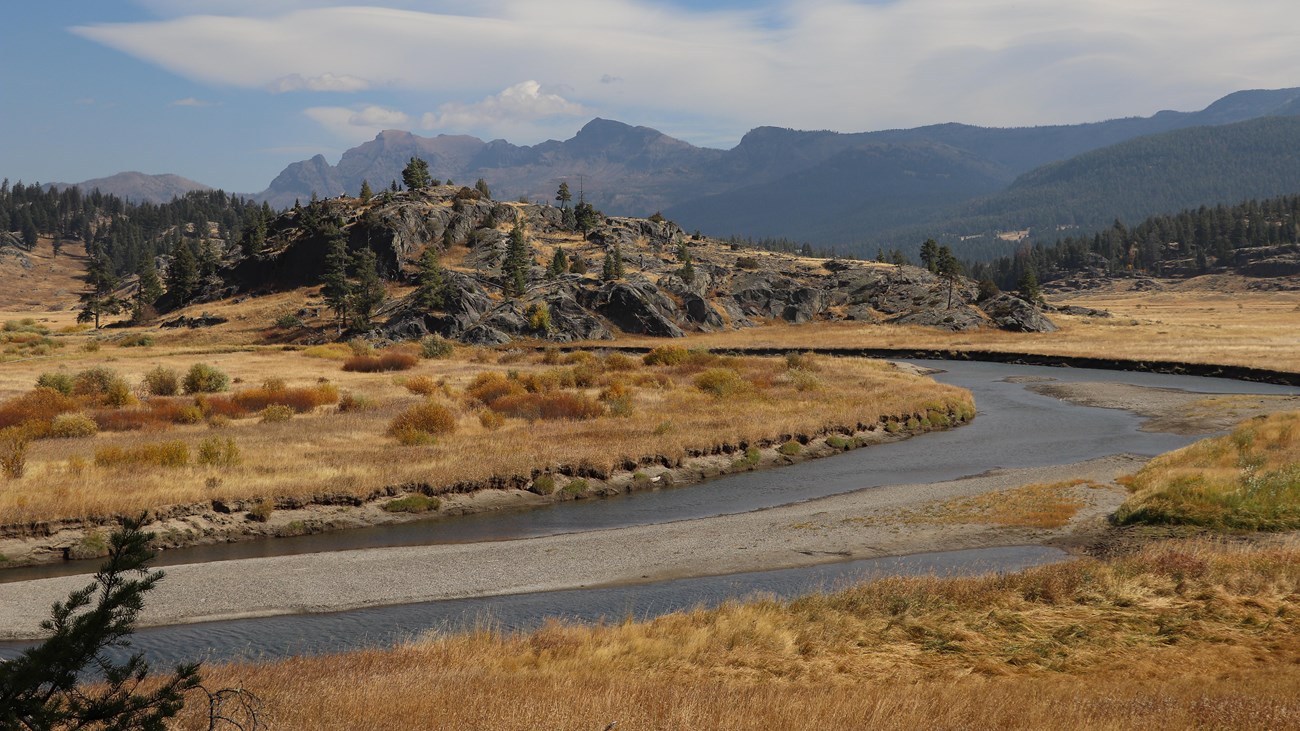
The route begins with a substantial climb on a broad historic wagon road, then descends toward the first meadow and Slough Creek. The open valley is excellent habitat for wildlife, including bears and moose, but sightings are never guaranteed.
The first meadow is the turnaround for the standard day hike. Continuing another 2.6 miles to the second meadow makes the full outing 8.6 miles round trip. Only extend the hike with enough time, water, and current route information.
Directions and parking
Drive toward Slough Creek Campground east of Tower Junction. Where the dirt road bends left, park near the vault toilet at the signed trailhead. Gravel-road and parking conditions can change, so follow posted instructions.
Horses, fishing, and wildlife
The route is shared with horses and horse-drawn wagons. When stock approaches, move to the downhill side of the trail and stand still until it passes. Anglers need a Yellowstone fishing permit and must follow current park regulations. Carry bear spray, keep a wide distance from every animal, and never block wildlife’s path.
Put the GPX on your watch
- Download the GPX from the map.
- Garmin: import it as a Course in Garmin Connect and sync it.
- COROS: add it to the COROS route library and sync it.
- Apple Watch: use WorkOutDoors, Footpath, Gaia GPS, or another GPX-capable app.
- For another device, look for GPX import under Routes, Courses, or Navigation.
- Verify that the track ends at the first meadow and is available offline.
Current conditions
Check current Yellowstone conditions and the backcountry situation report before hiking. Seasonal wildlife activity, wet roads, fire, or trail work can affect access.
Slough Creek Trail FAQ
How long is the Slough Creek day hike?
The standard route to the first meadow is 3.4 miles round trip. Continuing to the second meadow increases the full hike to 8.6 miles.
Is Slough Creek Trail difficult?
The NPS rates it moderate. The trail starts with a steep climb, and the open country can add heat, wind, and wildlife considerations.
Does the GPX go to the second meadow?
No. This GPX intentionally covers the standard day-hike route only, ending at the first meadow.
Related Yellowstone hikes
- Trout Lake Trail — a shorter northeast Yellowstone route
- Bunsen Peak Trail — a northern Yellowstone summit hike
This generalized GPX is for planning and does not replace trail signs, an official map, or current NPS instructions. Facts checked against the National Park Service Slough Creek Trail guide. GPX source: NPS Yellowstone trail centerline data.