
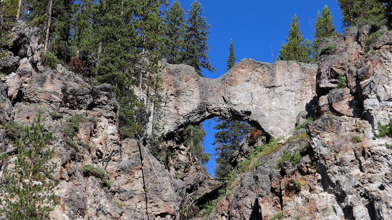
Natural Bridge Trail in Yellowstone is an easy 2.5-mile out-and-back from Bridge Bay Marina to a 51-foot rhyolite cliff carved through by Bridge Creek. Most of the route is fairly level and follows forest trail and an old service road.
This guide covers parking, family and biking considerations, seasonal bear closures, an interactive map, and a downloadable GPX track. Browse other approachable routes in our Hiking with Kids collection.
Trail Details
| Full hike | 2.5-mile out-and-back |
| GPX coverage | 1.26 miles one way |
| Difficulty | Easy |
| Time | 1–2 hours |
| Surface | Semi-paved trail and old service road |
| Trailhead | Bridge Bay Marina parking lot |
Distance note: the GPX is one way. Retrace it to return for the official 2.5-mile outing.
Natural Bridge Trail map and GPX
The map follows the hiking approach from Bridge Bay to the rock formation. GPX Viewer includes the article’s single download button.
natural-bridge-trail GPX
| Name: | No data |
| Distance: | No data |
| Minimum elevation: | No data |
| Maximum elevation: | No data |
| Elevation gain: | No data |
| Elevation loss: | No data |
| Duration: | No data |
What the hike is like
The first section meanders through forest before joining an old service road. At Natural Bridge, a short, steep switchback path reaches viewpoints around the formation. The top of the bridge itself is closed to hiking and biking to protect the fragile rock.
The generally easy grade makes this a practical family option, but creek-side rocks can be wet and slippery. Keep children close and remain on the designated route.
Directions, parking, and bicycles
Park at Bridge Bay Marina near the campground entrance road. A separate bike route begins just south of the marina; bicycles are allowed only on the service-road portion and not on the hiking path around the bridge. Follow current signs at every junction.
Put the GPX on your watch
- Download the GPX from the map.
- Garmin: import it as a Course in Garmin Connect and sync it.
- COROS: save it to the COROS route library and sync it.
- Apple Watch: import it with WorkOutDoors, Footpath, Gaia GPS, or another GPX-capable app.
- For another device, look for GPX import under Routes, Courses, or Navigation.
- Confirm that the one-way route is available offline, then retrace it to Bridge Bay.
Bear closure and current conditions
The trail is generally closed in early summer while bears feed on spawning trout in Bridge Creek. Never enter a closed trail. Check current Yellowstone conditions and ask at Fishing Bridge Visitor Center about the opening date.
Natural Bridge Trail FAQ
How long is Natural Bridge Trail?
The standard hike from Bridge Bay is 2.5 miles round trip and usually takes 1–2 hours.
Is Natural Bridge Trail good for kids?
It can be a good family route because it is mostly level. Adults should manage wildlife safety and supervise children on the steeper, wetter paths near the bridge.
Can you walk across the top of Natural Bridge?
No. The top is closed to hiking and biking to protect the fragile formation.
Related Yellowstone hikes
- Storm Point Trail — an easy loop along Yellowstone Lake
- Elephant Back Mountain Trail — a steeper nearby overlook route
This generalized GPX is for planning and does not replace trail signs or current NPS instructions. Facts checked against the National Park Service Natural Bridge Trail guide. GPX source: NPS Yellowstone trail centerline data.