
Harlequin Lake Trail in Yellowstone is an easy, roughly 1-mile out-and-back hike near Madison Junction. A gentle uphill path through lodgepole pine leads to a small lake known for lily pads and quiet forest scenery.
This guide covers distance, parking, what to expect, an interactive route map, and the GPX track. For broader planning, visit our Hiking in Yellowstone guide.
Trail Details
| Full hike | About 1 mile |
| GPX coverage | 0.48 miles of mapped geometry |
| Route | Short lollipop / return |
| Difficulty | Easy |
| Time | 30–60 minutes |
| Elevation | Gentle uphill; not included in the GPX |
| Trailhead | 1.5 miles west of Madison Junction |
Distance note: the mapped centerline contains 0.48 miles of geometry. Follow the signed trail and return the same way for the full outing.
Harlequin Lake Trail map and GPX
Use the interactive map to preview the route. The map includes the article’s single GPX download link.
harlequin-lake-trail GPX
| Name: | No data |
| Distance: | No data |
| Minimum elevation: | No data |
| Maximum elevation: | No data |
| Elevation gain: | No data |
| Elevation loss: | No data |
| Duration: | No data |
What to expect
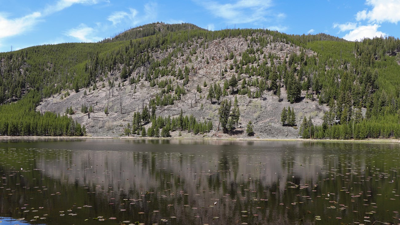
The path climbs gently through young lodgepole forest before reaching the wetland-fringed lake. It is more intimate than dramatic: come for a relaxed woodland walk, reflections on the water, and the chance to slow down between larger Yellowstone stops.
The trail is short, but it is still bear country. Keep children close, make noise where visibility is limited, and carry bear spray. Mosquitoes can be noticeable near the water in summer, so insect repellent is useful.
Distance note: the NPS describes the complete outing as approximately 1 mile. The downloadable mapped centerline contains 0.48 miles of geometry; use the signed trail and return to the trailhead rather than treating the GPX length as the entire walk.
Directions and parking
From Madison Junction, drive 1.5 miles west on the West Entrance Road and park at the third pullout. The Harlequin Lake trail begins at the pullout and climbs gently toward the lake.
Load the GPX on your watch
- Download the GPX to your phone or computer.
- Garmin: import it as a Course in Garmin Connect and send it to your compatible device.
- COROS: import it into the COROS app route library and sync the saved route to your watch.
- Apple Watch: use a GPX-compatible navigation app such as WorkOutDoors, Footpath, or Gaia GPS.
- For another brand, open its companion app and look under Routes, Courses, or Navigation.
- Confirm the route is available offline before entering the park.
Before you go
Pets are not allowed on the trail. Check current backcountry conditions and obey posted notices at the trailhead.
Harlequin Lake Trail FAQ
How long does Harlequin Lake Trail take?
Most visitors should allow 30–60 minutes for the hike, plus extra time at the lake.
Is Harlequin Lake Trail good for families?
The short distance and gentle grade make it one of Yellowstone’s more approachable walks. It is still an unpaved bear-country trail, so keep children close and carry bear spray.
Does the GPX show the entire hike?
The generalized centerline contains 0.48 miles of mapped geometry. Follow the signed trail to the lake and return the same way for an outing of roughly 1 mile.
Related Yellowstone hikes
- Mystic Falls Trail — a waterfall hike near Biscuit Basin
- Storm Point Trail — an easy Yellowstone Lake loop
This GPX is a planning aid, not a guarantee of current trail conditions. NPS signs, closures, and official guidance take priority. Facts checked against the National Park Service Harlequin Lake Trail guide. GPX source: NPS Yellowstone trail centerline data.