
Avalanche Peak Trail in Yellowstone is a strenuous 4.2-mile round-trip summit hike with about 2,100 feet of climbing. The route rises quickly from forest to loose alpine terrain and a narrow ridge with broad views across the Absaroka Range.
This guide covers the route, parking, best season, major hazards, interactive map, and GPX track. For more trip planning, start with our Hiking in Yellowstone guide.
Trail Details
| Full hike | About 4.2 miles round trip |
| GPX coverage | 2.09 miles one way |
| Route | Out and back |
| Elevation gain | About 2,100 feet |
| Difficulty | Strenuous |
| Time | 3–4 hours |
| Trailhead | Eleanor Lake pullout |
Distance note: the GPX reaches the summit. Retrace it for the full round trip.
Avalanche Peak Trail map and GPX
Use the interactive map to preview the climb and elevation profile. The map includes the article’s single GPX download link; the track covers the one-way route to the summit.
avalanche-peak-trail GPX
| Name: | No data |
| Distance: | No data |
| Minimum elevation: | No data |
| Maximum elevation: | No data |
| Elevation gain: | No data |
| Elevation loss: | No data |
| Duration: | No data |
What the hike is like
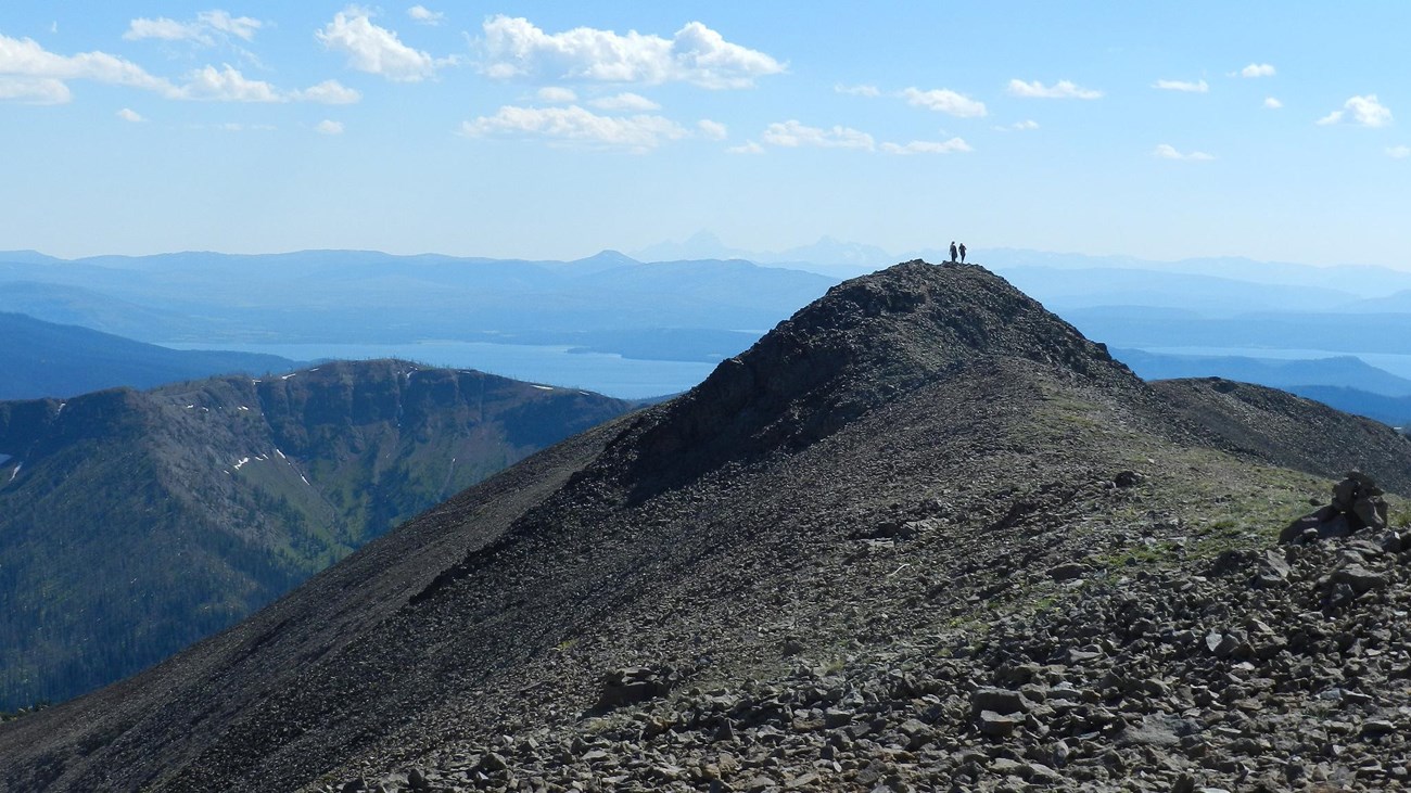
The climb begins almost immediately in the trees. After roughly a mile, the route reaches the broad bowl below Avalanche Peak, then works upward across rockier, more exposed slopes. The final approach reaches a narrow ridgeline where wind, loose footing, and sudden weather deserve your full attention.
This is a high-effort hike with a high-reward summit. It is best for hikers who are comfortable with sustained climbing and exposed alpine conditions. The descent follows the same trail and can be demanding on knees and ankles.
Directions and parking
Park at the Eleanor Lake pullout, 19 miles east of Fishing Bridge Junction or 8 miles west of Yellowstone’s East Entrance. The trailhead is across the road from the pullout, to the right of the creek. Cross carefully and begin on the established trail.
Best time to hike Avalanche Peak
Snow often lingers into early July. Above treeline, lightning, strong wind, and rapidly falling temperatures are serious concerns even when the morning begins clear. The National Park Service discourages this hike in September and October because grizzly bears frequent the area while searching for whitebark pine nuts.
Distance note: this file contains the mapped 2.09-mile trail from the trailhead to the summit. Because the hike is out and back, plan on approximately 4.2 miles total.
Put the GPX on a Garmin, COROS, or smartwatch
- Download the GPX to your phone or computer.
- Garmin: import it into Garmin Connect as a Course, then send or sync the course to your compatible watch.
- COROS: open the COROS app, import the GPX into the route library, save it, and sync it to the watch.
- Apple Watch: import it into a GPX-capable app such as WorkOutDoors, Footpath, or Gaia GPS, then sync through that app.
- Other watches: look for “Routes,” “Courses,” or “Navigation” in the maker’s app and choose its GPX import option.
- Open the route on the watch before leaving cell service and confirm it appears correctly.
Before you go
Carry bear spray where you can reach it, hike in a group, bring warm layers and rain protection, and turn around if clouds build near the summit. Check the Yellowstone Backcountry Conditions and current park conditions immediately before your hike.
Avalanche Peak Trail FAQ
How hard is Avalanche Peak Trail?
It is strenuous. The trail gains about 2,100 feet in 2.1 miles, crosses loose talus, and finishes on an exposed ridge. Allow roughly 3–4 hours, more if your pace or summit stop requires it.
Is the Avalanche Peak GPX a round trip?
No. The GPX maps the 2.09-mile route from the trailhead to the summit. Follow the same track in reverse for the descent and a full outing of about 4.2 miles.
Can I hike Avalanche Peak in September or October?
The National Park Service does not recommend the hike in September or October because grizzly bears frequent the area while seeking whitebark pine nuts.
Related Yellowstone hikes
- Storm Point Trail — an easier Yellowstone Lake loop
- Riddle Lake Trail — a gentler lake hike south of Grant Village
Planning file only. Trail geometry and conditions can change; posted closures and official NPS guidance always take priority. Facts checked against the National Park Service Avalanche Peak Trail guide. GPX source: NPS Yellowstone trail centerline data.