
DeLacy Creek Trail in Yellowstone is an easy 5.8-mile out-and-back from the Craig Pass area to the shore of Shoshone Lake, Yellowstone’s largest backcountry lake. The route follows forest edge and open meadows and normally takes 3–5 hours.
This guide covers the day-hike turnaround, small parking area, wildlife, an interactive map, and a downloadable GPX track. Browse more routes in our Yellowstone Trails collection.
Trail Details
| Official hike | 5.8-mile out-and-back |
| GPX coverage | 2.93 miles one way to Shoshone Lake |
| Difficulty | Easy |
| Time | 3–5 hours |
| Season | Summer and fall |
| Trailhead | DeLacy Creek parking area near Craig Pass |
Distance note: the GPX is one way. Turn around at Shoshone Lake and retrace it for the official day hike.
DeLacy Creek Trail map and GPX
The map follows the NPS centerline from the Craig Pass road corridor through forest and meadow to Shoshone Lake. GPX Viewer provides the article’s single route-download button.
delacy-creek-trail GPX
| Name: | No data |
| Distance: | No data |
| Minimum elevation: | No data |
| Maximum elevation: | No data |
| Elevation gain: | No data |
| Elevation loss: | No data |
| Duration: | No data |
What the hike is like
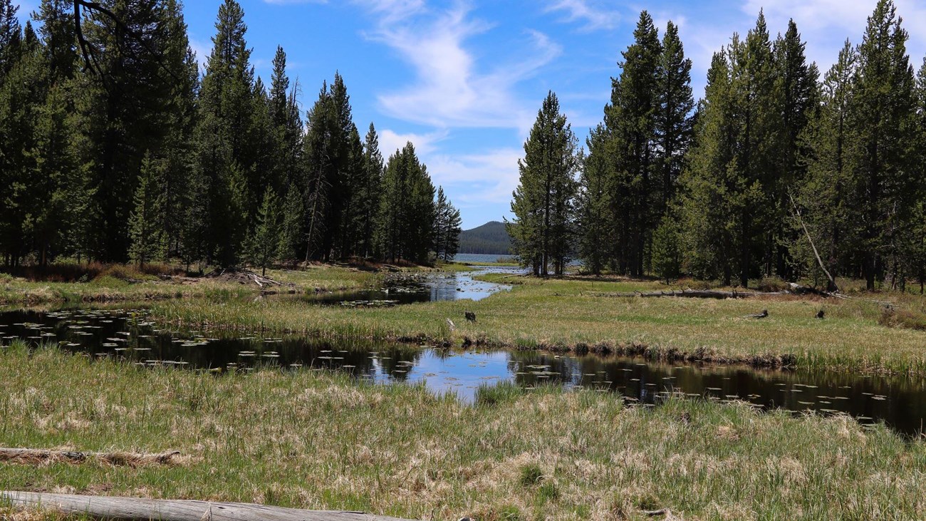
The trail descends gradually beside DeLacy Creek, alternating between lodgepole forest and broad meadows. The open ground can hold water and mosquitoes early in the season. Near Shoshone Lake, look for water birds and scan meadow and shoreline habitat from a safe distance.
The easy NPS rating describes the grade, not a short or developed walk. This is nearly six miles in backcountry terrain with limited services, wildlife, and changing weather.
Stop at Shoshone Lake on a day hike
The DeLacy Creek day hike ends at Shoshone Lake. Trails continue into Yellowstone’s larger backcountry, but this guide and GPX do not. Continuing requires different mileage, navigation, and possibly overnight planning; do not drift beyond the intended turnaround without the correct map and plan.
Directions and parking
The DeLacy Creek parking area is about 8.8 miles west of West Thumb Junction near Craig Pass. The roadside lot is small. Park only in designated space, make sure the vehicle is fully clear of traffic, and return later if no legal spot is available.
Wildlife and meadow travel
The NPS notes potential sandhill cranes in the meadows, moose near the shore, and water birds around the lake. Sightings are never guaranteed. Carry bear spray where it can be reached immediately, give moose and every other animal the required distance, and avoid blocking wildlife’s route.
Put the GPX on your watch
- Download the GPX from the map.
- Garmin: import it as a Course in Garmin Connect and sync it.
- COROS: add it to the COROS route library and sync it.
- Apple Watch: use WorkOutDoors, Footpath, Gaia GPS, or another GPX-capable app.
- For another device, look for GPX import under Routes, Courses, or Navigation.
- Confirm that the one-way route is offline, then retrace it from the lake.
Season and current conditions
The NPS lists summer and fall. Snow, wet meadows, mosquitoes, fire, wildlife, or temporary closures can affect the trip. Check current Yellowstone conditions and the backcountry situation report before departure.
DeLacy Creek Trail FAQ
How long is DeLacy Creek Trail?
The standard day hike to Shoshone Lake and back is 5.8 miles and usually takes 3–5 hours.
Is DeLacy Creek Trail difficult?
The NPS rates the trail easy because of its grade, but the 5.8-mile distance and backcountry setting still require water, layers, navigation, and wildlife preparation.
Can I keep hiking beyond Shoshone Lake?
Trails continue, but the NPS day hike stops at the lake. This guide and GPX are not designed for a longer backcountry trip.
Related Yellowstone hikes
- Lone Star Geyser Trail — an easy, longer route near the Old Faithful corridor
- Riddle Lake Trail — another south-side lake hike with seasonal wildlife closures
This generalized GPX is for planning and does not replace trail signs or current NPS instructions. Facts checked against the National Park Service DeLacy Creek Trail guide. GPX source: official NPS map centerlines.