
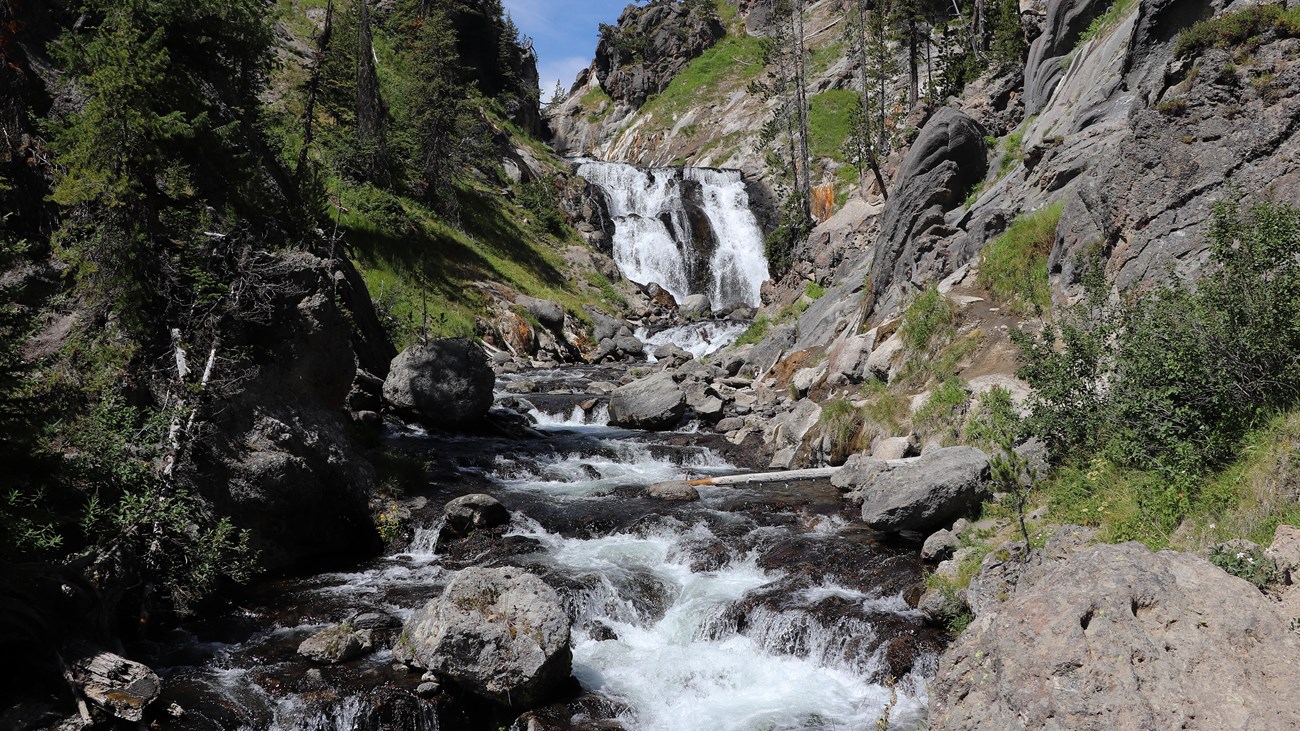
Mystic Falls Trail in Yellowstone is a moderately strenuous 2.4-mile out-and-back hike to a 70-foot waterfall on the Little Firehole River. The route combines a forested creek walk with access from the Biscuit Basin area.
This guide covers mileage, two trailhead approaches, the optional overlook, thermal-area safety, an interactive map, and the GPX track. For more planning, visit our Hiking in Yellowstone guide.
Trail Details
| Full hike | 2.4 miles round trip |
| GPX coverage | 1.30 miles one way |
| Route | Out and back |
| Difficulty | Moderately strenuous |
| Time | 2–4 hours |
| Elevation | Standard route not supplied; overlook climbs 500 feet |
| Area | Biscuit Basin / Upper Geyser Basin |
Extension note: the optional overlook loop adds about 1.5 miles and a 500-foot climb; it is not part of this GPX.
Mystic Falls Trail map and GPX
Use the interactive map to preview the standard falls route and elevation profile. The map includes the article’s single GPX download link; the overlook extension is not included.
mystic-falls-trail GPX
| Name: | No data |
| Distance: | No data |
| Minimum elevation: | No data |
| Maximum elevation: | No data |
| Elevation gain: | No data |
| Elevation loss: | No data |
| Duration: | No data |
What the hike is like
The route follows the Little Firehole River through mixed conifer forest to the waterfall. The standard trip turns around at the falls. Stronger hikers can climb switchbacks roughly 500 feet to an overlook of the Upper Geyser Basin and loop back to the main trail.
This is hydrothermal country. Stay on maintained trails and boardwalks; apparently solid ground near thermal features can be dangerously thin. Access arrangements can change when nearby thermal areas close, so verify the currently approved trailhead before driving there.
Distance note: the NPS lists the standard falls hike as 2.4 miles round trip. This centerline file maps 1.30 miles in one direction. It does not include the optional overlook extension or every step required from your parking location.
Directions and parking
The primary approach starts at Biscuit Basin: walk about 0.3 miles across the boardwalk to the trailhead. The NPS also describes parking in pullouts about 0.25 miles south of Biscuit Basin, then walking roughly 0.5 miles north on the Upper Geyser Basin–Biscuit Basin Trail. Confirm current access before leaving because nearby thermal-area closures can change the approach.
Use the GPX on a Garmin, COROS, or other watch
- Save the GPX on your phone or computer.
- Garmin: import it as a Course in Garmin Connect, then sync the course to your compatible watch.
- COROS: import the GPX into the COROS route library and sync it to the watch.
- Apple Watch: import the file into a GPX-capable app such as WorkOutDoors, Footpath, or Gaia GPS.
- On other platforms, use the companion app’s Routes, Courses, or Navigation import.
- Check the route on the device while you still have internet access.
Current access matters
Check the Yellowstone Backcountry Conditions for the latest access route, bear activity, and closures. Also review current park conditions on the day of your hike.
Mystic Falls Trail FAQ
How long is Mystic Falls Trail?
The standard falls hike is 2.4 miles round trip and typically takes 2–4 hours. The optional overlook loop adds about 1.5 miles and 500 feet of climbing.
Does the Mystic Falls GPX include the overlook?
No. The file maps the standard one-way route to Mystic Falls. It does not include the optional overlook loop or every step from your parking space.
Can I leave the trail near thermal features?
No. Stay on maintained trails and boardwalks. Ground near hydrothermal features can be dangerously thin even when it looks solid.
Related Yellowstone hikes
- Harlequin Lake Trail — a short walk near Madison Junction
- Riddle Lake Trail — an easy southern Yellowstone lake hike
This GPX is for trip planning. It may not reflect temporary reroutes or closures. Follow posted signs and NPS instructions. Facts checked against the National Park Service Mystic Falls Trail guide. GPX source: NPS Yellowstone trail centerline data.